

Stuc an Lochain [Stuchd an Lochain]
Good walks are even better shared.
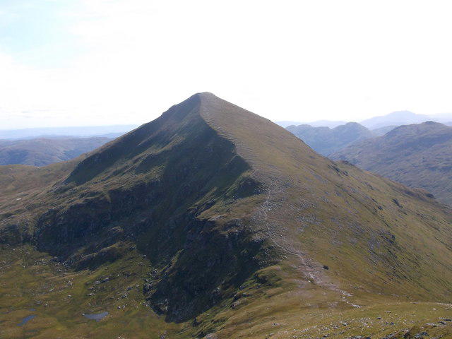
NN4844 : The steep north-facing slopes of Coire an Lochain
Richard Law Photo source
Overview
Overview
Stuc an Lochain, or Stuchd an Lochain as it is lovingly referred to, stands proudly at 925 meters in the heart of the Scottish Highlands. This Munro is not just a peak; it's a gateway to some of the finest views Scotland has to offer.
Geology
The bedrock of Stuc an Lochain is a mix of sandstone and granite. This combination, shaped by ancient glacial movements, creates a unique landscape that can make you feel like you are walking on the Moon—minus the lack of oxygen!
Routes
The Ben Lawers Circuit is a favourite among hikers, offering a moderately challenging route of about 10 km. Starting from the Ben Lawers car park, it takes approximately 4 hours to complete, allowing plenty of time to enjoy the sights without breaking a sweat.
Summit Features
Reaching the summit rewards those who hoist themselves up with a charming rocky cairn and breathtaking views that feel like something straight out of a postcard. On a clear day, you might even spot your next holiday destination!
Terrain
Prepare for a variety of terrain stretches, including rocky paths and grassy slopes. Don’t forget, the Highland weather loves to keep hikers on their toes; a sunny morning can turn into a boggy adventure by noon!
Views
From the pinnacle of Stuc an Lochain, you'll be treated to majestic views of Loch Tay and nearby peaks like Ben Lawers and Meall Greigh. The idyllic landscape is best enjoyed during the spring and early autumn when the skies are generally clearer.
Hazards
Like all Highland adventures, pay heed to the ever-changing weather. Conditions can morph in the blink of an eye, so pack accordingly and don't underestimate the terrain's slippery side.
Access
Parking
Park your vehicle at the Ben Lawers visitor centre car park (NN 583 399). Space is limited, so an early start is always advisable!
Public Transport
Public transport is limited in this part of the world, with the nearest bus service originating from Killin. Many hikers typically drive to the location.
Nearest Town
After your escapades, a visit to the charming town of Killin, just 7 miles away, can provide the perfect opportunity to refuel with a well-deserved meal.
Facilities
Facilities at the car park are limited to information boards and basic toilet access. For a proper caffeine fix or lunch, you'll need to venture into Killin.
History
The name Stuc an Lochain means 'peak of the lake', a nod to the stunning loch below. Historically, the beauty of this area has inspired generations of artists and maintains its own cultural significance.
Conclusion
Whether you seek adventure, solitude, or a picturesque picnic spot, Stuc an Lochain has something for everyone. Remember to tread carefully, respect the land, and, most importantly, have fun. Happy hiking!
Explore routes near Stuc an Lochain [Stuchd an Lochain]
Walks starting near this hill. Open a route to check its map, distance and full itinerary.
Killin: Falls of Dochart, Finlarig and Moirlanich Longhouse
View route
Kenmore: Drummond Hill Black Rock Trail above Loch Tay
View route
Loch Lubnaig: West Shore Railway Path from Ben Ledi Car Park
View route
Aberfeldy: Glassie Woodland and River Tay Circular
View route
Route planning notes
These notes describe possible approaches. Check a route's map and access information when planning your walk.
Ben Lawers Circuit
This popular circuit begins at the Ben Lawers car park and leads upwards through a scenic route that offers excellent opportunities for spotting wildlife.
Make a day of it, together
Find someone to share the walk with, or organise a day out along a route you like.
Photo Gallery
View all Photo could not load
NN4844 : The steep north-facing slopes of Coire an Lochain
Richard Law
 Photo could not load
NN4844 : Summit view, Stuchd an Lochain
Stephen Sweeney
 Photo could not load
NN4844 : The last pull to the top
Richard Law
 Photo could not load
NN4844 : Stuc an Lochain
G Laird
 Photo could not load
NN4844 : Summit of Stuchd an Lochain
Iain Russell
 Photo could not load
NN4844 : Stuchd an Lochain summit ridge
Iain Russell
 Photo could not load
NN4844 : Stuc an Lochain Summit Cairn
G Laird
 Photo could not load
NN4844 : Summit cairn, Stuc an Lochain
Tim Glover
 Photo could not load
NN4844 : View west northwest from Stùc an Lochain
Nigel Brown

NN4844 : On top of Stuchd an Lochain
Alan Reid
Hill facts and local notes
Classifications
Elevation
960m
3,148 ft
Prominence
481m
Coordinates
56.5709, -4.4706
NN483448
OS Map
51
Explorer: OL48W 378W
At the Summit
Stuc an Lochain features a distinctive rocky summit with a small Cairn. The views from the top are nothing short of spectacular and are worth the effort required to get there.
Terrain & Geology
Predominantly consists of sandstone and granite, offering a rugged landscape shaped by glacial activity. The rock formations are a testament to the Earth's tumultuous history and create stunning vistas for lucky hikers.
Views & Scenery
Incredible panoramic views of Loch Tay, Ben Lawers, and the surrounding peaks of the Southern Highlands are visible from the summit.
History & Heritage
Name Origin
Stuc an Lochain translates to 'peak of the lake', highlighting the mountain's position overlooking Loch Tay.
Historical Significance
Historically, the area around Stuc an Lochain has been significant for its natural beauty, attracting artists and writers to capture its essence, as well as being home to a variety of Scottish wildlife.
Getting There & Facilities
Parking
The nearest parking is at the Ben Lawers visitor centre car park (NN 583 399), which has space for several vehicles and provides access to multiple walking routes.
Public Transport
Access via public transport is a bit tricky; the nearest bus service operates from Killin. Hikers typically need to arrange private transportation to the starting point.
Nearby Facilities
Limited facilities are available at the car park, including information boards and toilet facilities. The nearest cafes and shops can be found in Killin.
Safety Information
Known Hazards
- Variable weather can change quickly in the Highlands, and paths can be muddy and slippery, particularly after rain. Always check the weather forecast before heading out.
General Safety Tips
- Check weather conditions before setting out
- Carry appropriate clothing and equipment
- Let someone know your planned route
- Take a map, compass, and GPS device
- Carry emergency supplies: food, water, first aid kit, torch
Hills
Some common questions about the hills answered
Are there group walks up Stuc an Lochain [Stuchd an Lochain]?
Many walkers use Walkmates to join or organise walks with others. You can check for group walks around Stuc an Lochain [Stuchd an Lochain] through the maps
Are there other walkers around Stuc an Lochain [Stuchd an Lochain]?
Activity varies by location and time, but Walkmates lets you see whether others have shared walks or shown interest in this area. Find other people through the walking friends search walking friends for Stuc an Lochain [Stuchd an Lochain] search or of course create your own walk for Stuc an Lochain [Stuchd an Lochain]
Can I organise a walk to Stuc an Lochain [Stuchd an Lochain]?
Yes. If there aren’t any walks listed already, you can create a walk and make it available for others to join.
If you're signed up to Walkmates, you can create a walk to Stuc an Lochain [Stuchd an Lochain].
How do I find a walk up this hill?
There are often multiple ways to walk this hill, depending on experience and route preference. Walkmates helps you explore walks and routes that others have shared.
Can I suggest a new route up Stuc an Lochain [Stuchd an Lochain]?
Yes. You can suggest or create routes to share with others. Walkmates focuses on the social side of walking, so routes are used to help people organise walks and explore areas together, rather than as detailed navigation tools or route libraries.
Other uses really appreciate knowledgeable walkers sharing their routes. Share your favourite route to Stuc an Lochain [Stuchd an Lochain] here
The is an error or something incorrect about this hill. How do I let you know?
We always strive to keep the information on Walkmates as accurate as possible. If you find an error, please let us know through the contact form and we'll aim to correct it as quickly as possible
Community Discussion
Comments
Location
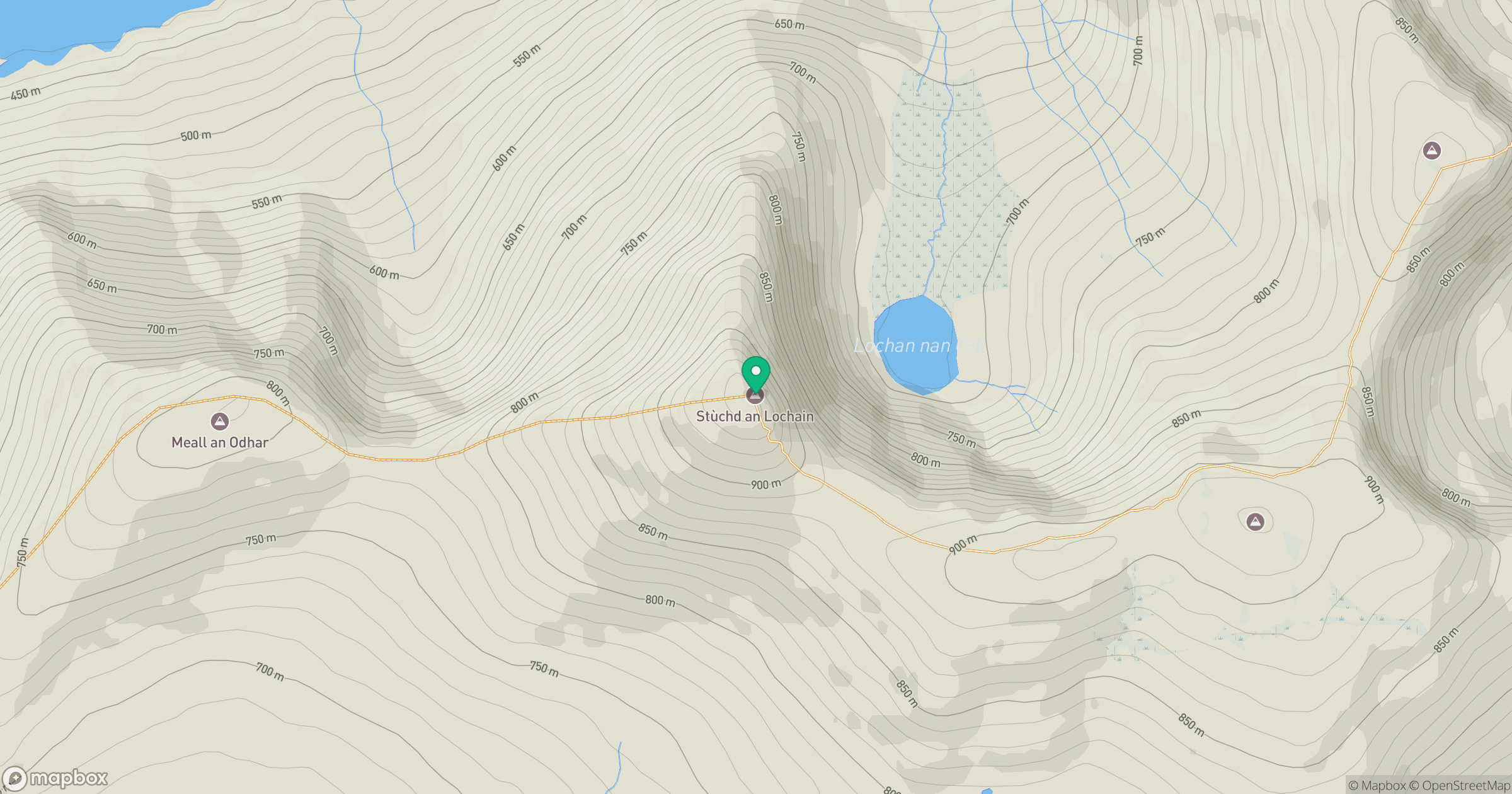
Grid reference: NN483448
View on OpenStreetMapOpens a map in a new tab, centred on the hill.
No comments yet. Be the first.